


Eric Rahne, B.Sc. in Electrical Engineering, Level 3 Accredited Thermography Expert (PIM Ltd.)
Our thermography series aims to provide insight into the incredible versatility and theoretical as well as practical limitations of thermography, drawing from Rahne Eric's 650-page specialized book "THERMOGRAPHY - theory and practical measurement technology." This section is a continuation of the previous article titled "Energy Systems and Aerial Thermography."
When it comes to the inspection of power lines, in addition to limitations related to outdoor measurements, the geometric resolution is critical from a measurement technology perspective. For the assessment of overloads and the transient resistance increase of even 18 mm diameter strands at a height of 30 m, a geometric resolution of 0.2 mrad or even better, i.e., a large "optical zoom" telephoto lens is required. Some faults in insulators can still be detected with lower geometric resolution. The following thermal images are unsuitable for thermographic evaluation due to the time of measurement and visible geometric resolution, regardless of whether they were taken from the ground or the air (by helicopter, airplane, or drone). (Unfortunately, these examples are typical of the majority of current overhead line surveys conducted, with hardly any accurate measurements among publications and promotional materials!) Thermographic sample images for overhead power lines that are not evaluable:
![aerial image of power line (clearly showing daytime heating) [H51]](/images/3967/VLxx-1-300x219.png)
![effect of sunlight heating [H53]](/images/3968/VLxx-2-300x225.png)
Accurate thermographic sample images for faults in overhead power lines:
![power line with fault [T167]](/images/3969/VLxx-3-300x209.png)
![drone detail (taken using [H54])](/images/3970/VLxx-4-300x213.png)
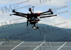
The nature of the mentioned measurements, the quantity of related images, and the difficulties related to field of view and viewing angle specifically call for the application of aerial thermography. A typical application is thermographic surveys from airplanes or helicopters in environmental protection, environmental monitoring (e.g., water management, agriculture, or wildlife monitoring), and large-scale archaeological and geological research. The aerial survey of solar systems, especially large-scale, multi-hectare photovoltaic power plants, is becoming increasingly common, facilitated by the emergence of drones with higher payload capacity and easier applicability, even automatable missions. (Of course, it should be noted that the use of drones is subject to strict regulations and legal requirements, with additional technical and legal risks to consider.) The main advantage of aerial images is the ability to inspect large areas relatively quickly at an optimal viewing angle, practically without shading risks. However, this technology is not without challenges. To obtain sharp, correctly focused thermal images, the distance from the measured solar tables and modules must be strictly adhered to. The motorized focusing of high-performance thermal cameras is quite energy-intensive, requiring larger batteries for the thermal camera. Due to the relatively shallow depth of field of thermal cameras, it is advisable to look as close to perpendicular as possible at the module panels, provided that the angle of sunlight does not interfere, to ensure sharpness across the entire image. Capturing images while in motion poses a challenge. The maximum flight speed must be determined based on the integration time of the applied thermal camera to calculate pixel elongation, along with the measurement distance and capture frequency depending on the smallest detectable fault location. Since these parameters are interdependent, it is advisable to use a decision-making, mission planning table based on a simple system of equations presented on the following page. The flight speed parameters should be adjusted until an acceptable, optimal flight time and image quantity are achieved. Additionally, consideration must be given to the width of the thermal image measured perpendicular to the flight direction. If this safely exceeds the width of a solar cell table, then it is sufficient to fly the rows once. Otherwise, multiple flyovers exponentially increase the required time and image quantity.

The above table is calculated based on the parameters of a relatively small thermal camera that can be transported by an electric drone. With a higher-performance, multi-pixel, shorter integration time thermal camera, the 72,000 modules on the segmented 31-hectare surface can be surveyed in significantly less time and with potentially half or a third of the number of images. The equations used in the table are covered in the relevant theoretical sections of the book, and we will not repeat them here. The next step is to create the flight plan, i.e., the planning of individual missions. The capacity of the thermal camera's memory is usually not the issue; rather, it is the flight time and range of the drone used. To address this problem in advance, it is advisable to plan the most optimal routes based on the layout of the solar tables, rows of modules, and the overall segmentation of the field. Having accurate GPS coordinates, cartographic data, and altitude profiles of the solar cell park to guide the drone in a mission-oriented, automated manner is highly beneficial.
The (abbreviated) text, figures, and thermal images source: Rahne Eric: THERMOGRAPHY - theory and practical measurement technology 656 pages (A4, color), 303 figures, 452 images, 754 thermal images, 50 tables ISBN 978-963-87401-6-8 (printed book, no electronic edition) More information: www.termokamera.hu sources used in the above work (separately marked):
| H51 | www.infratec-infrared.com/uploads/tx_templavoila/Airborne-thermography-VarioCAM_InfraTec-HD_03.jpg |
| H53 | http://thermal-imaging-camera.irpod.net/wp-content/uploads/2012/01/Wire_Animation.gif |
| H54 | www.workswell-thermal-camera.com/wp-content/uploads/2016/07/vysoke_napeti.png |
| K265 | Rotors & Cams Ltd. and PIM Ltd. |
Rahne Eric (PIM Ltd.) pim-ltd.com, termokamera.hu
The content of the publication is protected by copyright, and its (even partial) use, electronic or printed re-publication is only allowed with the indication of the source and the author's name, as well as with the prior written permission of the author. Infringement of copyright (Copyright) will have legal consequences.
Copyright © PIM Professzionális Ipari Méréstechnika Kft.
2026 | Minden jog fenntartva
Impresszum | Adatkezelés